Unveiled Titan
The Cassini Synthetic Aperture Radar (SAR) has been acquiring
images of Titan's surface since October 2004.
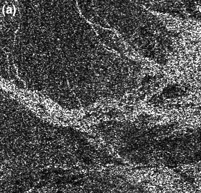
Radar data suffer from speckle noise hindering interpretation of small-scale features and comparison of reimaged
regions for topography derivation and potential detection. By combining a state of the art denoising algorithm with mapping and quantitative
measurements we greatly offer previously unattainable insights and introducing the denoising version of the Cassini SAR named NLDSAR.
Dedicated website
Lucas et al., Insights into Titan's geology and hydrology based on enhanced image processing of Cassini RADAR data
Journal of Geophys. Research, doi:10.1002/2013JE004584, 2014.
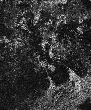
Leilah Fluctus (55°N,80°W):
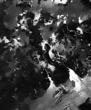
Elivagar Flumina (20°N,80°W):
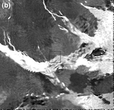
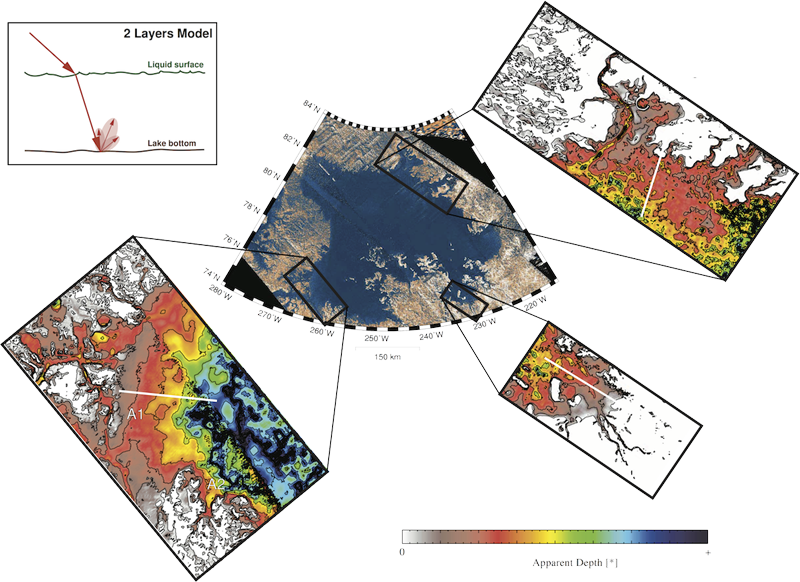
Bathymetry maps of near-shore regions of Ligeia Mare from NLDSAR. Radar backscatter values were converted to apparent depth (i.e., depth/loss the tangent) using a two-layer model of radar energy penetration in the liquid [Hayes et al., 2010]. Tweet
Updated October 2, 2014.